
Flood Zone Extensions: How England Homeowners Avoid Validation Delays
England homeowners: learn what an FRA must show, how to check the Flood Map for Planning, and avoid compensatory-storage and validation delays.
Flood Zone Extensions: How England Homeowners Avoid Validation Delays
Most house extensions can still go ahead in a flood zone. What changes is the evidence you need: check the Environment Agency’s Flood Map for Planning and your council’s validation list first, and if you’re in Zone 2 or 3, expect to submit a proportionate flood risk assessment covering finished floor levels, compensatory storage, drainage and safe access.
TL;DR:
- Extensions in Flood Zones 2 and 3 require site-specific flood risk assessments, especially if there are basements, converting outbuildings, or self-contained annexes.
- The assessment must include finished floor levels above the design flood level, flood-resistant measures, safe emergency routes, and drainage solutions like permeable paving or attenuation features.
- Compensatory flood storage should replicate lost floodplain volume at the same elevation to avoid worsening local flood behavior, with level-for-level storage preferred.
- Checking both the flood zone and surface-water layers on the Flood Map for Planning is essential, given surface water is the main flooding source affecting many properties.
- Coordinating design, planning, and construction through a single in-house team can streamline approvals, reduce delays, and ensure resilience measures are incorporated from the outset.
Table of Contents
- How to check your property’s official flood zone and surface-water status
- When does a house extension need a flood risk assessment?
- What must an FRA for an extension actually include?
- Compensatory flood storage: level for level or volume for volume?
- Practical checklist: from map check to submission
- How long does a flood risk assessment take, and what does it cost?
- Who should prepare the FRA, and how do you brief a consultant?
- Does flood zone extension planning affect your home insurance?
- How flood zone rules shape your choice of materials and construction methods
- Publisher perspective: what actually slows extensions down in flood zones
- Book a flood zone extension with one team, one price
- Sources
- FAQ
How to check your property’s official flood zone and surface-water status
Start with the Environment Agency’s Flood Map for Planning, which is the definitive tool planners actually use to decide flood zones for planning applications. That’s a different product from the public “long term flood risk” postcode checker most homeowners find first when they search online, and councils will not accept a screenshot from the wrong one.
Run two checks, not one. River and sea flood zones sit on one layer; surface-water risk (rainfall pooling and overwhelmed drains) sits on another, and a site can pass the first while failing the second, since surface water is the largest single flooding source in England, affecting a very large number of properties.
- Screenshot both the flood zone map and the surface-water layer, noting the date you pulled them.
- Check your local authority’s Strategic Flood Risk Assessment (SFRA) for site-specific flags.
- Look at your council’s validation checklist before submitting, since some boroughs demand more detail than the national minimum.
- Keep the raw map output on file. It’s the evidence your case officer will compare against your own submission.
When does a house extension need a flood risk assessment?
Zone matters more than almost anything else here. As a rule of thumb, extensions in Flood Zones 2 and 3 need a site-specific flood risk assessment (FRA), while Zone 1 sites usually don’t, unless the site is a hectare or larger or your council’s evidence flags a surface-water or critical drainage problem.
Householder extensions get one useful exemption: the Sequential Test, which normally forces developers to prove there’s no reasonably available lower-risk site, doesn’t apply to you. You’re still bound by the technical FRA requirements set out in national policy (often referenced as tests F4 and F7), which cover flood resistance, resilience and safe access regardless of scale.
A few situations catch people out:
- Basements or below-ground rooms in Zone 2 or 3 almost always trigger a full FRA, even for a modest single-storey scheme above them.
- Converting a garage or outbuilding to habitable space can change the flood-risk classification of the whole plot.
- A new self-contained annexe (its own kitchen and bathroom) is often assessed as a separate dwelling for flood-risk purposes, not as an extension.
- Permitted development doesn’t remove the need to satisfy building regulations on flood resistance, even where full planning permission isn’t required.
What must an FRA for an extension actually include?
A proportionate FRA for a householder extension isn’t a research paper. It needs to answer four practical questions clearly enough that a case officer can sign it off without asking for more.
- Finished floor level. This should sit above the design flood level, which combines the Environment Agency’s modelled flood level with an allowance for freeboard and, in many cases, climate change over the lifetime of the development. Your designer sets this using EA data plus engineering judgement, not guesswork.
- Resistance and resilience below the design flood level. Think flood-resistant doors and airbrick covers, plus resilience measures like raised electrical sockets, water-resistant plaster below dado height and consumer units positioned above expected flood depth.
- Safe access and egress. The FRA needs a route for occupants to leave (or reach a refuge point) during a flood event, not just a statement that the building itself will survive.
- Drainage and sustainable drainage systems (SuDS). New hard surfaces from an extension increase run-off unless offset, so permeable paving, soakaways or attenuation features usually need to appear on the drawings, not just in the text.
Pro Tip: Ask your designer to mark the design flood level and finished floor level on the same section drawing you submit for planning. Case officers see dozens of FRAs a week; a drawing that shows the numbers visually, rather than burying them in a paragraph, tends to get through validation faster.
Compensatory flood storage: level for level or volume for volume?
Planning policy exists to stop your extension pushing flood risk onto your neighbours, and that’s the entire logic behind compensatory flood storage: if your development removes floodplain storage capacity, you replace it, on the same site, so there’s no net loss elsewhere.
Level for level is the preferred method. It means recreating lost storage at the same elevation it was lost, analysed in slices, typically 100 to 300 millimetre bands, so the new storage fills and empties on the same timing as the ground it replaced. Get this wrong and you can technically hit the right total volume while still worsening flood behaviour on your street, because the water arrives or drains at the wrong moment.
Volume for volume is the accepted fallback for minor developments where site topography makes strict level-for-level replacement impractical. In practice, that usually means digging out an equivalent volume somewhere contiguous with the extension, on the same flood frontage, rather than scattering compensation across the garden.
- Compensation must be hydraulically linked to where the storage was lost, not just numerically equal.
- Voids under a raised extension or stilted construction are commonly refused unless a council agrees to them in writing beforehand, because unconstrained voids don’t reliably drain when floodwater recedes.
- Design compensation with future climate-change allowances in mind. Councils are scrutinising displaced floodwater more closely than they used to, and a scheme that only just balances today’s flood level can fall short once the development’s projected lifetime is factored in.
Practical checklist: from map check to submission
The fastest route through validation is sequencing your evidence correctly, not gathering more of it than you need.
- Check the Flood Map for Planning and surface-water layer, and cross-reference your council’s SFRA and validation checklist.
- Decide early whether a homeowner-prepared flood statement will be accepted or whether the site (Zone 3, surface-water flag, basement) needs a specialist consultant.
- Set your finished floor level and drainage strategy with your design team before drawings are finalised, not after a refusal.
- Document compensatory storage on the same plans as the extension footprint, showing volumes and levels, if the site requires it.
- Submit a clear, proportionate FRA or flood statement rather than a generic template, and keep any follow-up queries from the case officer short and specific.
Pro Tip: If your council’s validation list asks for a “flood risk assessment” but your site is low risk, ask the duty planning officer whether a shorter flood statement referencing Environment Agency standing advice will satisfy that requirement. It often will, and it saves weeks.
How long does a flood risk assessment take, and what does it cost?
A simple, proportionate FRA for a single-storey rear extension in a straightforward Zone 2 or 3 site can turn around in roughly a week once your consultant has the site plans and the Flood Map for Planning output. Sites needing hydraulic modelling, detailed slice analysis for compensatory storage, or coordination with a Lead Local Flood Authority on drainage can stretch to several weeks or, in complex cases, months.
Cost tracks complexity closely:
- A baseline desktop FRA for a low-risk extension sits at the cheaper end.
- Sites needing modelled flood levels, slice-by-slice compensatory storage design, or SuDS calculations cost more, because they involve engineering time, not just report writing.
- A well-specified FRA submitted first time round is usually cheaper overall than a rushed one that triggers a validation query or a refusal and a resubmission.
Spending properly on the assessment upfront, rather than treating it as a box to tick, is consistently the difference between a smooth eight-week planning process and one that drags into a second round of consultation.
Who should prepare the FRA, and how do you brief a consultant?
Environment Agency standing advice lets your local planning authority decide many straightforward householder cases without referring them to the EA directly, which means a homeowner-prepared flood statement is often perfectly acceptable for a low-risk Zone 1 or simple Zone 2 extension.
Hire a specialist once you’re in Zone 3, flagged for surface water, or adding a basement. When you brief one, ask for four specific deliverables in writing:
- A finished floor level calculation referenced against the design flood level, not an estimate.
- Slice or volume compensatory storage analysis, if the site requires it.
- A drainage and SuDS plan showing how run-off is managed, not just described.
- A clear statement confirming no net loss of flood storage capacity.
A consultant who hands you a generic ten-page report without these four items has given you paperwork, not a planning tool your case officer can actually approve against.
Does flood zone extension planning affect your home insurance?
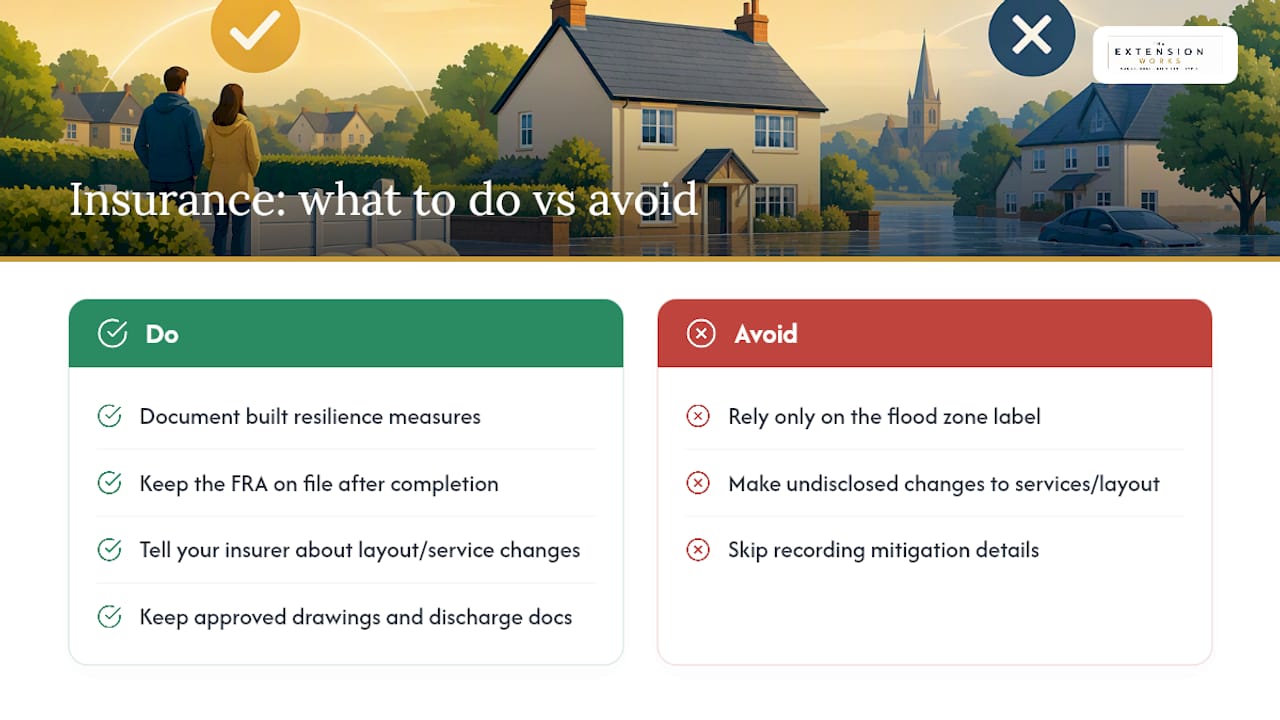
Building in a flood zone changes what insurers ask for, and it can change your premium, though the effect depends far more on your flood resistance and resilience measures than on the zone label alone.
Insurers increasingly want to know what you’ve actually built, not just where you’ve built it. An extension with raised electrical sockets, flood-resistant doors and a finished floor level set safely above the design flood level looks like a lower risk to an underwriter than an identical-looking extension with none of those details, even in the same flood zone. That’s one reason it pays to keep your FRA and its resilience specification on file after completion, because you may need to show an insurer exactly what mitigation was built in, not just what planning approved.
Properties in Flood Zone 3 without documented resilience measures can face higher premiums or, in a minority of cases, difficulty securing standard cover at all, which is why some homeowners now use the government-backed Flood Re scheme as a route to affordable insurance on higher-risk homes. If your extension adds a basement, alters ground floor layout, or changes where services like consumer units and boilers sit, tell your insurer proactively. Undisclosed changes to a flood-risk property are a common reason claims get contested later, and it’s far cheaper to have that conversation before a flood than after one.
If you’re planning compensatory storage or drainage works as part of the extension, keep the approved drawings and any conditions discharge documentation. Insurers and future buyers alike will ask for it, and a well-documented FRA can genuinely support a lower premium rather than just satisfying the council.
How flood zone rules shape your choice of materials and construction methods
Flood zone status doesn’t just dictate paperwork. It changes what your builder actually specifies below the design flood level, and getting this wrong is a common reason resilience measures fail in a real flood rather than in an inspection.
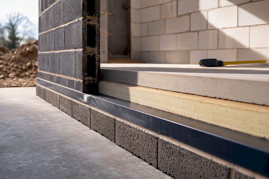
Below the design flood level, materials need to survive being wet and dry out without collapsing or trapping moisture. That typically means dense, water-resistant blockwork rather than standard plasterboard partitions, lime-based or cement-based renders instead of gypsum plaster, and solid timber or composite doors rated for flood resistance rather than standard hollow-core units. Flooring choices matter just as much: ceramic tile or polished concrete recovers from a flood far better than laminate or carpet, which usually needs full replacement after even a shallow flood event.
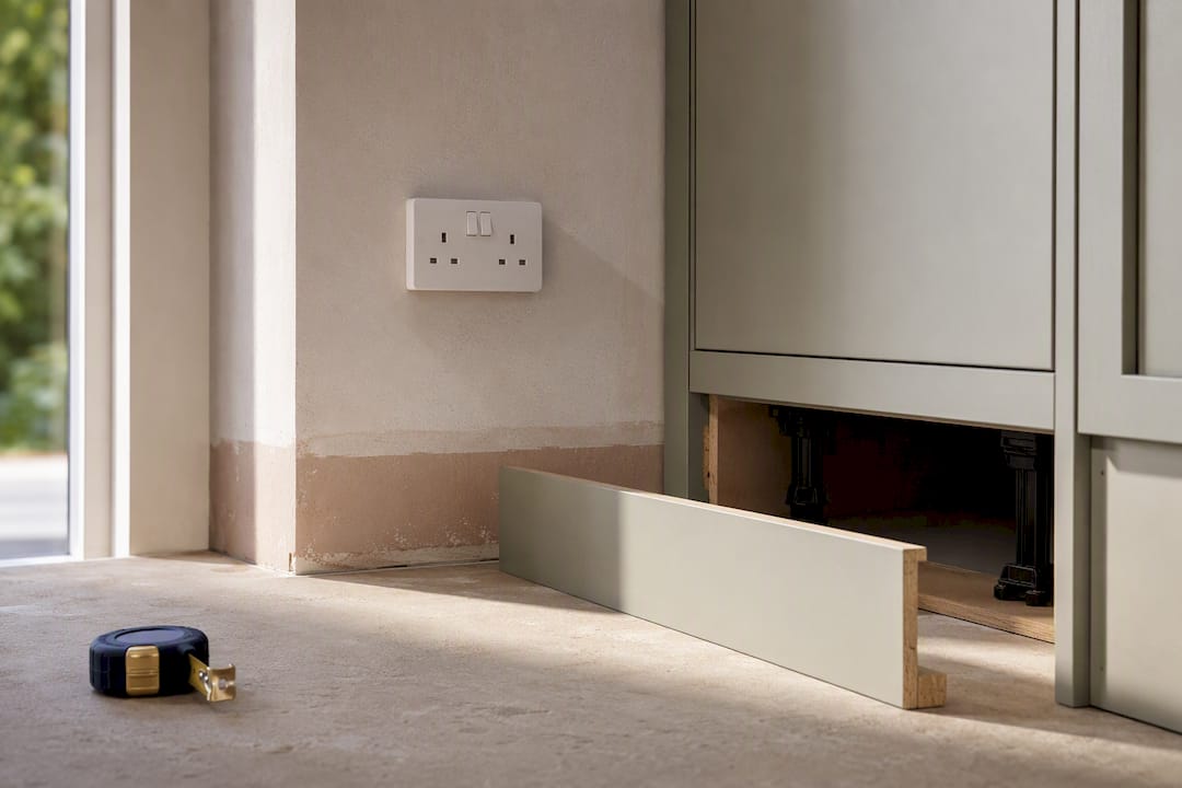
Services and fittings move up, not just materials. Consumer units, boilers, and electrical sockets typically sit above the anticipated flood depth, with wiring run in loops that allow a lower section to be isolated and dried out without rewiring the whole extension. Kitchen units in flood-resistant designs are sometimes built with removable plinths so cabinets can be lifted clear rather than gutted.
None of this is exotic specification. It’s standard construction practice adapted with flood resistance in mind, and it’s exactly the kind of detail that should already be on your FRA and your build specification before work starts, not added retrospectively after a planning condition flags it. A clear set of planning drawings that shows finished floor levels and material specifications together makes it far easier for a case officer, and later a building control inspector, to see that resilience has actually been designed in rather than assumed.
Publisher perspective: what actually slows extensions down in flood zones
The delays we see most often aren’t caused by genuinely difficult sites. They come from homeowners checking the wrong map, leaving compensatory storage as an afterthought, or submitting drainage details too vague for a case officer to sign off first time. Coordinating design, planning and construction under one roof closes that gap, because the finished floor level and drainage strategy get fixed before drawings go anywhere near validation, not after a refusal forces a rethink.
— Esskay
Book a flood zone extension with one team, one price
An alternative to juggling separate architects, planning consultants and builders for a rear extension in or near a flood zone is to have one team manage the Flood Map for Planning checks, drainage and compensatory storage detail, planning submission, and construction under a single fixed VAT-inclusive price.

This approach matters most on sites covered in detail: Flood Zone 3 plots, sites flagged for surface water, or any extension needing slice-by-slice compensatory storage design. Rather than briefing a planning consultant separately and hoping your builder’s drainage detail matches what got approved, having the design, the FRA-related evidence and the build specification handled by the same team from the first sketch to sign off, backed by a warranty on the finished work, can streamline the process.
If you want a realistic sense of cost and design options before committing, the instant extension quote tool gives you a fixed price with live 3D modelling in minutes. When you’re ready to move forward, booking a single-storey rear extension starts with a £499 one-off booking fee, and every stage from there, including flood-zone documentation, is managed in-house.
Sources
Cross-check your own findings against the primary sources planners themselves rely on:
Before finalising outdoor works tied to your extension, it’s also worth checking planning rules for decking and outbuildings, since garden works in the same flood zone can carry their own drainage conditions.
FAQ
Can I build an extension in Flood Zone 2?
Yes. Flood Zone 2 extensions usually proceed with a site-specific flood risk assessment covering finished floor levels, resilience measures and drainage. Refusals in Zone 2 are far more often about missing FRA detail than about the zone itself.
Can you build next to a floodplain?
Building directly adjacent to a floodplain is generally possible, but your FRA will need to demonstrate that the extension won’t reduce floodplain storage capacity or worsen flood flow onto neighbouring land. Compensatory storage is the usual mechanism councils require to allow this.
Where can I find the Flood Map for Planning for my property?
The official tool is the Environment Agency’s Flood Map for Planning, searchable by postcode or address. It’s distinct from the general public flood risk checker, and it’s the version your case officer will check your submission against.
Which parts of England face the highest long-term flood risk?
Low-lying coastal and estuarine areas, including parts of the East of England, the Thames Estuary and sections of the Humber, carry the highest long-term flood risk as sea levels rise and river catchments change. Surface-water flooding, however, is widespread well beyond these areas, affecting a very large number of properties nationally according to government guidance, so checking both map layers for your specific site matters more than relying on regional reputation alone.
Does The Extension Works handle the flood risk assessment for me?
The Extension Works coordinates flood-zone map checks, drainage and compensatory storage detail, and planning submission as part of its integrated design-and-build service for single-storey rear extensions. For complex sites needing specialist hydraulic modelling, a dedicated flood consultant may still be brought in as part of that managed process.